One of the first steps of a construction project is to get a topographic survey to have a good understanding of the environment during which the project will be planned. Digital elevation models and Digital surface models acquired through the drone data can show possible drainage points, elevation alterations and many other factors that will assist in planning and selecting the simplest locations for building, earthmoving, digging or storing material.
Planning, engineering and designing
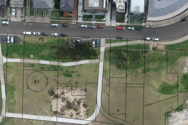
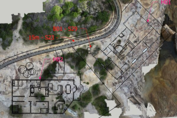
All the information collected with the drone can be used by different planning processes in different work areas like architects, engineers, council analyses and graphic designers. With the photogrammetry and the 3d model you can virtually place the building onto the actual scenario to see how it might look and how it could impact in the area. With the 3d models it’s possible to analyse the shadows and even predict how the view/outlook of the final building would be. Curbs, manholes, ducts, fences, roads can be measured precisely and files can be imported to CAD or GIS to help with the engineering processes.
Monitoring Progress
Considering the quick, easy and low cost of any drone service, it’s possible to create survey records hourly, daily, weekly or monthly depending on how the project is advancing. This way, the project and site managers have more control of the tasks and can be on top of the deadlines. During the construction phase, site managers have to control and validate completed work in order to permit continued work. The faster you are able to check and validate a task, the faster you can move on to the next task, saving time along the overall construction process.
Planned vs Execution
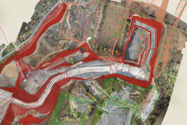
Another drone application that allows you to compare the planned vs executed is to overlay the orthophoto with the CAD, this is crucial to get real-time information and make the right decisions with more accuracy. Site managers can then identify differences between planned and real-time progress and steer projects accordingly.
Communication Tool
With all the information (videos, photos, 3d models) of the construction site, stakeholders can have more visual access without the need of visiting the local, which makes it easy to make or change any decision. That can also be used for customers to check if the progress and the budget are being followed.
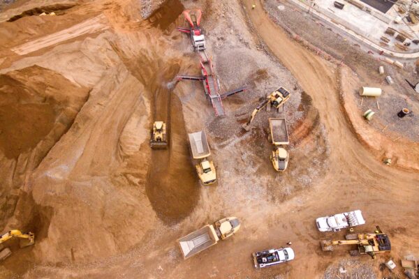
Earthworks
With a drone, it’s possible to calculate the volume of moved material either by being dug or by moving a pile of material (with a photogrammetry software). That’s the most accurate and quick way to obtain this information, which helps reduce the margin of error, of the progress of a job that was either being done by one of your team or contractors, that leads to a good cut of the cost.